
The proposal by developer Benny Marotta for intense subdivision development on the land behind the Rand Estate on John Street increases the potential for flooding of One Mile Creek as it winds through Old Town in Niagara on the Lake. Friends of One Mile Creek (FOMC) made two presentations to raise concerns about the plans for water management in a five-hour Town Council Public Meeting on July 14.
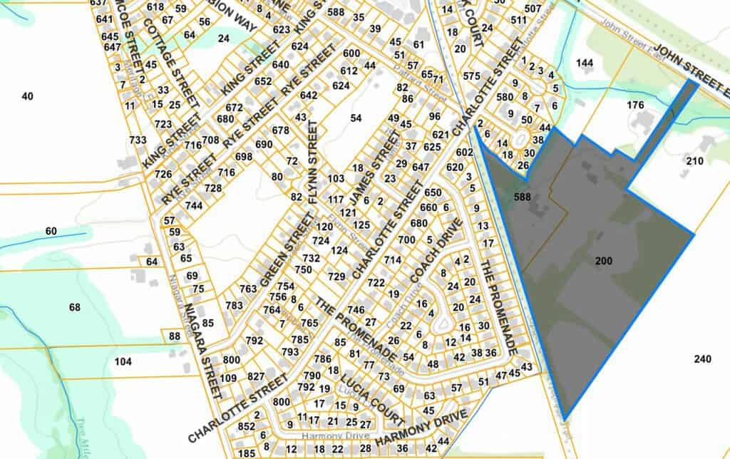
The area involved is a former agricultural and wooded landscape that makes up part of the headwaters of One Mile Creek — the origin of the creek. Today, rainfall is absorbed on the open land to slowly infiltrate into the ground.
According to the developer’s land use schedule, of the total 30 acres, 10 acres for the area cannot be developed — the greenbelt area, natural heritage and stream and buffer. Of the remaining 20 acres, about 15 acres will be built on — with housing, streets, sidewalks, patios. This means that 75% of the development land will be covered with impermeable surfaces — roofs, asphalt, concrete.
The developer is asking for exemptions from Town standards so the density of the proposed subdivision can be two to three times more packed than the neighbourhoods on adjacent streets. Also, because of the high water table in the area, the developer proposes to bring in fill to raise the level of the grade by eight to 10 feet.
The combination of impermeable surfaces that do not absorb water and the raised grade mean that there will need to be massive storage tanks installed on top of the existing grade and then covered with fill. It is proposed that these storage tanks will be able to hold storm runoff to be slowly released into the creek. However, no details have been provided about the capacity of the storage tanks and no studies have been provided to calculate whether the storage will be sufficient to manage the amount of water falling on 15 acres of roofs and pavement.
Already there is serious flooding of One Mile Creek along John Street as it exits the Rand Estate where clear cutting trees in 2018 reduced the site’s natural capacity to absorb rainfall.
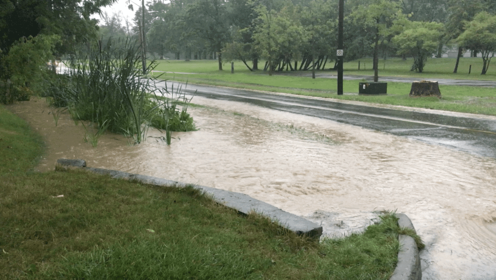
From the site, One Mile Creek winds for about 1.6 kilometres through Old Town — behind houses on streets such as William St., Johnson St., Simcoe St., Gage St and Landsdowne St. — before eventually reaching Lake Ontario. With higher water flows surging from the development site, the concern is that the creek will over flow its natural basin and flood properties downstream.
FOMC argues in its submissions that the density of the development should not exceed the existing standards. Also, there is little use of green infrastructure or low-impact development practices in the proposed development. Because the development will retain condominium ownership on private land, there are questions about how the water storage system would be maintained over a period of years.
You can read below the FOMC submissions to the Town.
Leave a Reply